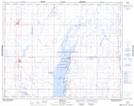
Maps showing Bulrush Lake, 28-25-W2, Saskatchewan
Bulrush Lake is a Lake located in 28-25-W2, Saskatchewan and has an elevation of 510 meters.
- Latitude: 51° 22' North (decimal: 51.3667019)
- Longitude: 105° 24' West (decimal: -105.4005867)
- Topography Feature Category: Lake
- Geographical Feature: Lake
- Canadian Province/Territory: Saskatchewan
- Elevation: 510 meters
- Location: 28-25-W2
- Atlas of Canada Locator Map: Bulrush Lake
- GPS Coordinate Locator Map: Bulrush Lake Lat/Long