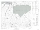
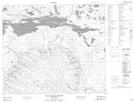
Maps showing Mang Lake, 69-17-W2, Saskatchewan
Mang Lake is a Lake located in 69-17-W2, Saskatchewan and has an elevation of 387 meters.
- Latitude: 54° 59' North (decimal: 54.9834001)
- Longitude: 104° 29' West (decimal: -104.4837613)
- Topography Feature Category: Lake
- Geographical Feature: Lake
- Canadian Province/Territory: Saskatchewan
- Elevation: 387 meters
- Location: 69-17-W2
- Atlas of Canada Locator Map: Mang Lake
- GPS Coordinate Locator Map: Mang Lake Lat/Long
Mang Lake NTS Map Sheets