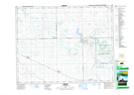
Maps showing Marguerite Lake, 31-16-12-W2, Saskatchewan
Marguerite Lake is a Lake located in 31-16-12-W2, Saskatchewan and has an elevation of 638 meters.
- Latitude: 50° 24' North (decimal: 50.4000298)
- Longitude: 103° 38' West (decimal: -103.6338622)
- Topography Feature Category: Lake
- Geographical Feature: Lake
- Canadian Province/Territory: Saskatchewan
- Elevation: 638 meters
- Location: 31-16-12-W2
- Atlas of Canada Locator Map: Marguerite Lake
- GPS Coordinate Locator Map: Marguerite Lake Lat/Long