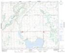
Maps showing Marsden, 35-44-27-W3, Saskatchewan
Marsden is a Village located in 35-44-27-W3, Saskatchewan and has an elevation of 639 meters.
- Latitude: 52° 50' 29'' North (decimal: 52.8414943)
- Longitude: 109° 49' 26'' West (decimal: -109.8238361)
- Topography Feature Category: Village
- Geographical Feature: Village
- Canadian Province/Territory: Saskatchewan
- Elevation: 639 meters
- Location: 35-44-27-W3
- Atlas of Canada Locator Map: Marsden
- GPS Coordinate Locator Map: Marsden Lat/Long
Marsden NTS Map Sheets