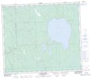
Maps showing Marshy Bay, Saskatchewan
Marshy Bay is a Bay located in Saskatchewan and has an elevation of 454 meters.
- Latitude: 54° 52' North (decimal: 54.8667538)
- Longitude: 108° 12' West (decimal: -108.2007136)
- Topography Feature Category: Bay
- Geographical Feature: Bay
- Canadian Province/Territory: Saskatchewan
- Elevation: 454 meters
- Atlas of Canada Locator Map: Marshy Bay
- GPS Coordinate Locator Map: Marshy Bay Lat/Long
Marshy Bay NTS Map Sheets