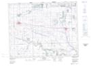
Maps showing Marston Lake, 16-6-W2, Saskatchewan
Marston Lake is a Lake located in 16-6-W2, Saskatchewan and has an elevation of 609 meters.
- Latitude: 50° 21' North (decimal: 50.3500170)
- Longitude: 102° 47' West (decimal: -102.7838398)
- Topography Feature Category: Lake
- Geographical Feature: Lake
- Canadian Province/Territory: Saskatchewan
- Elevation: 609 meters
- Location: 16-6-W2
- Atlas of Canada Locator Map: Marston Lake
- GPS Coordinate Locator Map: Marston Lake Lat/Long