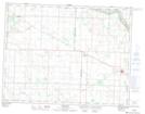
Maps showing Maryfield, 17-10-30-W, Saskatchewan
Maryfield is a Village located in 17-10-30-W, Saskatchewan and has an elevation of 577 meters.
- Latitude: 49° 50' 6'' North (decimal: 49.8349836)
- Longitude: 101° 31' 33'' West (decimal: -101.5258500)
- Topography Feature Category: Village
- Geographical Feature: Village
- Canadian Province/Territory: Saskatchewan
- Elevation: 577 meters
- Location: 17-10-30-W
- Atlas of Canada Locator Map: Maryfield
- GPS Coordinate Locator Map: Maryfield Lat/Long