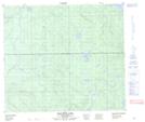
Maps showing McAlister Lake, 76-24-W3, Saskatchewan
McAlister Lake is a Lake located in 76-24-W3, Saskatchewan and has an elevation of 608 meters.
- Latitude: 55° 37' North (decimal: 55.6167721)
- Longitude: 109° 40' West (decimal: -109.6675014)
- Topography Feature Category: Lake
- Geographical Feature: Lake
- Canadian Province/Territory: Saskatchewan
- Elevation: 608 meters
- Location: 76-24-W3
- Atlas of Canada Locator Map: McAlister Lake
- GPS Coordinate Locator Map: McAlister Lake Lat/Long
McAlister Lake NTS Map Sheets