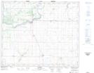
Maps showing McKay Creek, 13-45-27-W2, Saskatchewan
McKay Creek is a River located in 13-45-27-W2, Saskatchewan and has an elevation of 446 meters.
- Latitude: 52° 55' North (decimal: 52.9167049)
- Longitude: 105° 49' West (decimal: -105.8172016)
- Topography Feature Category: River
- Geographical Feature: Creek
- Canadian Province/Territory: Saskatchewan
- Elevation: 446 meters
- Location: 13-45-27-W2
- Atlas of Canada Locator Map: McKay Creek
- GPS Coordinate Locator Map: McKay Creek Lat/Long