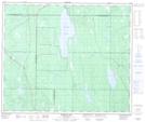
Maps showing McLean Creek, 56-25-W2, Saskatchewan
McLean Creek is a River located in 56-25-W2, Saskatchewan and has an elevation of 516 meters.
- Latitude: 53° 49' North (decimal: 53.8167157)
- Longitude: 105° 41' West (decimal: -105.6838138)
- Topography Feature Category: River
- Geographical Feature: Creek
- Canadian Province/Territory: Saskatchewan
- Elevation: 516 meters
- Location: 56-25-W2
- Atlas of Canada Locator Map: McLean Creek
- GPS Coordinate Locator Map: McLean Creek Lat/Long
McLean Creek NTS Map Sheets