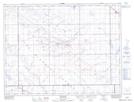
Maps showing McTaggart, 17-9-15-W2, Saskatchewan
McTaggart is a Village located in 17-9-15-W2, Saskatchewan and has an elevation of 578 meters.
- Latitude: 49° 43' 51'' North (decimal: 49.7308971)
- Longitude: 104° 0' 43'' West (decimal: -104.0118250)
- Topography Feature Category: Village
- Geographical Feature: Village
- Canadian Province/Territory: Saskatchewan
- Elevation: 578 meters
- Location: 17-9-15-W2
- Atlas of Canada Locator Map: McTaggart
- GPS Coordinate Locator Map: McTaggart Lat/Long
McTaggart NTS Map Sheets