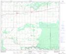
Maps showing Meath Park, 31-51-23-W2, Saskatchewan
Meath Park is a Village located in 31-51-23-W2, Saskatchewan and has an elevation of 483 meters.
- Latitude: 53° 26' 30'' North (decimal: 53.4417056)
- Longitude: 105° 22' 0'' West (decimal: -105.3667258)
- Topography Feature Category: Village
- Geographical Feature: Village
- Canadian Province/Territory: Saskatchewan
- Elevation: 483 meters
- Location: 31-51-23-W2
- Atlas of Canada Locator Map: Meath Park
- GPS Coordinate Locator Map: Meath Park Lat/Long
Meath Park NTS Map Sheets