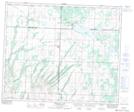
Maps showing Meeting Lake, 30-48-11-W3, Saskatchewan
Meeting Lake is a Unincorporated area located in 30-48-11-W3, Saskatchewan and has an elevation of 749 meters.
- Latitude: 53° 10' North (decimal: 53.1667301)
- Longitude: 107° 35' West (decimal: -107.5839513)
- Topography Feature Category: Unincorporated area
- Geographical Feature: Locality
- Canadian Province/Territory: Saskatchewan
- Elevation: 749 meters
- Location: 30-48-11-W3
- Atlas of Canada Locator Map: Meeting Lake
- GPS Coordinate Locator Map: Meeting Lake Lat/Long
Meeting Lake NTS Map Sheets