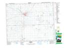
Maps showing Melville, Saskatchewan
Melville is a City located in Saskatchewan and has an elevation of 560 meters.
- Latitude: 50° 55' 50'' North (decimal: 50.9304305)
- Longitude: 102° 48' 28'' West (decimal: -102.8078416)
- Topography Feature Category: City
- Geographical Feature: City
- Canadian Province/Territory: Saskatchewan
- Elevation: 560 meters
- Atlas of Canada Locator Map: Melville
- GPS Coordinate Locator Map: Melville Lat/Long