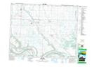
Maps showing Miller Lake, 14,23-19-31-W, Saskatchewan
Miller Lake is a Lake located in 14,23-19-31-W, Saskatchewan and has an elevation of 486 meters.
- Latitude: 50° 38' North (decimal: 50.6333323)
- Longitude: 101° 41' West (decimal: -101.6837989)
- Topography Feature Category: Lake
- Geographical Feature: Lake
- Canadian Province/Territory: Saskatchewan
- Elevation: 486 meters
- Location: 14,23-19-31-W
- Atlas of Canada Locator Map: Miller Lake
- GPS Coordinate Locator Map: Miller Lake Lat/Long
Miller Lake NTS Map Sheets