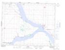
Maps showing Mistusinne, 20,29-24-4-W3, Saskatchewan
Mistusinne is a Village located in 20,29-24-4-W3, Saskatchewan and has an elevation of 543 meters.
- Latitude: 51° 3' 53'' North (decimal: 51.0647693)
- Longitude: 106° 31' 34'' West (decimal: -106.5260999)
- Topography Feature Category: Village
- Geographical Feature: Resort Village
- Canadian Province/Territory: Saskatchewan
- Elevation: 543 meters
- Location: 20,29-24-4-W3
- Atlas of Canada Locator Map: Mistusinne
- GPS Coordinate Locator Map: Mistusinne Lat/Long