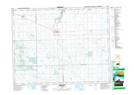
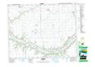
Maps showing Mitchell Creek, 31-18-10-W2, Saskatchewan
Mitchell Creek is a River located in 31-18-10-W2, Saskatchewan and has an elevation of 628 meters.
- Latitude: 50° 34' North (decimal: 50.5666921)
- Longitude: 103° 22' West (decimal: -103.3671863)
- Topography Feature Category: River
- Geographical Feature: Creek
- Canadian Province/Territory: Saskatchewan
- Elevation: 628 meters
- Location: 31-18-10-W2
- Atlas of Canada Locator Map: Mitchell Creek
- GPS Coordinate Locator Map: Mitchell Creek Lat/Long
Mitchell Creek NTS Map Sheets