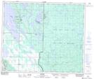
Maps showing Nesslin Creek, 57-6-W3, Saskatchewan
Nesslin Creek is a River located in 57-6-W3, Saskatchewan and has an elevation of 531 meters.
- Latitude: 53° 57' North (decimal: 53.9500554)
- Longitude: 106° 50' West (decimal: -106.8338801)
- Topography Feature Category: River
- Geographical Feature: Creek
- Canadian Province/Territory: Saskatchewan
- Elevation: 531 meters
- Location: 57-6-W3
- Atlas of Canada Locator Map: Nesslin Creek
- GPS Coordinate Locator Map: Nesslin Creek Lat/Long