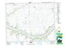
Maps showing Neudorf, 14-20-8-W2, Saskatchewan
Neudorf is a Village located in 14-20-8-W2, Saskatchewan and has an elevation of 600 meters.
- Latitude: 50° 42' 35'' North (decimal: 50.7097305)
- Longitude: 103° 0' 51'' West (decimal: -103.0142389)
- Topography Feature Category: Village
- Geographical Feature: Village
- Canadian Province/Territory: Saskatchewan
- Elevation: 600 meters
- Location: 14-20-8-W2
- Atlas of Canada Locator Map: Neudorf
- GPS Coordinate Locator Map: Neudorf Lat/Long