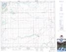
Maps showing Nicklen, 31-47-14-W2, Saskatchewan
Nicklen is a Unincorporated area located in 31-47-14-W2, Saskatchewan and has an elevation of 367 meters.
- Latitude: 53° 6' North (decimal: 53.1000273)
- Longitude: 104° 2' West (decimal: -104.0338024)
- Topography Feature Category: Unincorporated area
- Geographical Feature: Railway Point
- Canadian Province/Territory: Saskatchewan
- Elevation: 367 meters
- Location: 31-47-14-W2
- Atlas of Canada Locator Map: Nicklen
- GPS Coordinate Locator Map: Nicklen Lat/Long
Nicklen NTS Map Sheets