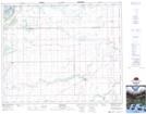
Maps showing Armley, 6-48-14-W2, Saskatchewan
Armley is a Unincorporated area located in 6-48-14-W2, Saskatchewan and has an elevation of 365 meters.
- Latitude: 53° 7' North (decimal: 53.1166943)
- Longitude: 104° 2' West (decimal: -104.0338021)
- Topography Feature Category: Unincorporated area
- Geographical Feature: Hamlet
- Canadian Province/Territory: Saskatchewan
- Elevation: 365 meters
- Location: 6-48-14-W2
- Atlas of Canada Locator Map: Armley
- GPS Coordinate Locator Map: Armley Lat/Long
Armley NTS Map Sheets