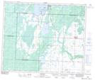
Maps showing Armstrong Lake, 17-53-12-W3, Saskatchewan
Armstrong Lake is a Lake located in 17-53-12-W3, Saskatchewan and has an elevation of 601 meters.
- Latitude: 53° 34' North (decimal: 53.5667393)
- Longitude: 107° 45' West (decimal: -107.7506341)
- Topography Feature Category: Lake
- Geographical Feature: Lake
- Canadian Province/Territory: Saskatchewan
- Elevation: 601 meters
- Location: 17-53-12-W3
- Atlas of Canada Locator Map: Armstrong Lake
- GPS Coordinate Locator Map: Armstrong Lake Lat/Long
Armstrong Lake NTS Map Sheets