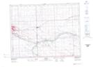
Maps showing West Short Creek, 11-1-7-W2, Saskatchewan
West Short Creek is a River located in 11-1-7-W2, Saskatchewan and has an elevation of 555 meters.
- Latitude: 49° 1' North (decimal: 49.0167040)
- Longitude: 102° 51' West (decimal: -102.8504518)
- Topography Feature Category: River
- Geographical Feature: Creek
- Canadian Province/Territory: Saskatchewan
- Elevation: 555 meters
- Location: 11-1-7-W2
- Atlas of Canada Locator Map: West Short Creek
- GPS Coordinate Locator Map: West Short Creek Lat/Long