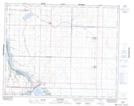
Maps showing Strongfield, 26-27-5-W3, Saskatchewan
Strongfield is a Village located in 26-27-5-W3, Saskatchewan and has an elevation of 616 meters.
- Latitude: 51° 19' 58'' North (decimal: 51.3327194)
- Longitude: 106° 35' 46'' West (decimal: -106.5960639)
- Topography Feature Category: Village
- Geographical Feature: Village
- Canadian Province/Territory: Saskatchewan
- Elevation: 616 meters
- Location: 26-27-5-W3
- Atlas of Canada Locator Map: Strongfield
- GPS Coordinate Locator Map: Strongfield Lat/Long