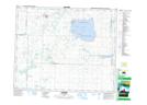
Maps showing Swystun Bay, Saskatchewan
Swystun Bay is a Bay located in Saskatchewan and has an elevation of 517 meters.
- Latitude: 52° 39' North (decimal: 52.6500559)
- Longitude: 107° 13' West (decimal: -107.2172803)
- Topography Feature Category: Bay
- Geographical Feature: Bay
- Canadian Province/Territory: Saskatchewan
- Elevation: 517 meters
- Atlas of Canada Locator Map: Swystun Bay
- GPS Coordinate Locator Map: Swystun Bay Lat/Long