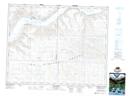
Maps showing Taggart Bay, Saskatchewan
Taggart Bay is a Bay located in Saskatchewan and has an elevation of 569 meters.
- Latitude: 50° 44' North (decimal: 50.7333665)
- Longitude: 107° 13' West (decimal: -107.2173159)
- Topography Feature Category: Bay
- Geographical Feature: Bay
- Canadian Province/Territory: Saskatchewan
- Elevation: 569 meters
- Atlas of Canada Locator Map: Taggart Bay
- GPS Coordinate Locator Map: Taggart Bay Lat/Long
Taggart Bay NTS Map Sheets