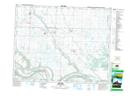
Maps showing Tantallon, 16-18-32-W, Saskatchewan
Tantallon is a Village located in 16-18-32-W, Saskatchewan and has an elevation of 425 meters.
- Latitude: 50° 32' 8'' North (decimal: 50.5355108)
- Longitude: 101° 50' 27'' West (decimal: -101.8408416)
- Topography Feature Category: Village
- Geographical Feature: Village
- Canadian Province/Territory: Saskatchewan
- Elevation: 425 meters
- Location: 16-18-32-W
- Atlas of Canada Locator Map: Tantallon
- GPS Coordinate Locator Map: Tantallon Lat/Long
Tantallon NTS Map Sheets