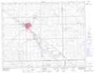
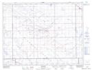
Maps showing Tatagwa Lake, 7,8-15-W2, Saskatchewan
Tatagwa Lake is a Lake located in 7,8-15-W2, Saskatchewan and has an elevation of 579 meters.
- Latitude: 49° 37' North (decimal: 49.6166958)
- Longitude: 104° 2' West (decimal: -104.0338779)
- Topography Feature Category: Lake
- Geographical Feature: Lake
- Canadian Province/Territory: Saskatchewan
- Elevation: 579 meters
- Location: 7,8-15-W2
- Atlas of Canada Locator Map: Tatagwa Lake
- GPS Coordinate Locator Map: Tatagwa Lake Lat/Long
Tatagwa Lake NTS Map Sheets