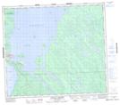
Maps showing Ted Island, Saskatchewan
Ted Island is a Island located in Saskatchewan.
- Latitude: 55° 54' North (decimal: 55.9000881)
- Longitude: 108° 22' West (decimal: -108.3673844)
- Topography Feature Category: Island
- Geographical Feature: Island
- Canadian Province/Territory: Saskatchewan
- Atlas of Canada Locator Map: Ted Island
- GPS Coordinate Locator Map: Ted Island Lat/Long
Ted Island NTS Map Sheets