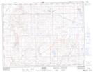
Maps showing The Weir, 34-10-27-W3, Saskatchewan
The Weir is a Lake located in 34-10-27-W3, Saskatchewan and has an elevation of 787 meters.
- Latitude: 49° 52' North (decimal: 49.8667090)
- Longitude: 109° 35' West (decimal: -109.5840940)
- Topography Feature Category: Lake
- Geographical Feature: Lake
- Canadian Province/Territory: Saskatchewan
- Elevation: 787 meters
- Location: 34-10-27-W3
- Atlas of Canada Locator Map: The Weir
- GPS Coordinate Locator Map: The Weir Lat/Long
The Weir NTS Map Sheets