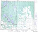
Maps showing Nyberg Point, 32-53-27-W2, Saskatchewan
Nyberg Point is a Cape located in 32-53-27-W2, Saskatchewan and has an elevation of 517 meters.
- Latitude: 53° 37' North (decimal: 53.6167161)
- Longitude: 105° 57' West (decimal: -105.9504983)
- Topography Feature Category: Cape
- Geographical Feature: Point
- Canadian Province/Territory: Saskatchewan
- Elevation: 517 meters
- Location: 32-53-27-W2
- Atlas of Canada Locator Map: Nyberg Point
- GPS Coordinate Locator Map: Nyberg Point Lat/Long
Nyberg Point NTS Map Sheets