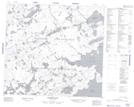
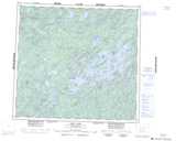
Maps showing O'Donnell Island, Saskatchewan
O'Donnell Island is a Island located in Saskatchewan and has an elevation of 497 meters.
- Latitude: 57° 16' North (decimal: 57.2667686)
- Longitude: 107° 10' West (decimal: -107.1673120)
- Topography Feature Category: Island
- Geographical Feature: Island
- Canadian Province/Territory: Saskatchewan
- Elevation: 497 meters
- Atlas of Canada Locator Map: O'Donnell Island
- GPS Coordinate Locator Map: O'Donnell Island Lat/Long
O'Donnell Island NTS Map Sheets