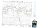
Maps showing Omache Bay, Saskatchewan
Omache Bay is a Bay located in Saskatchewan and has an elevation of 573 meters.
- Latitude: 50° 40' North (decimal: 50.6667059)
- Longitude: 107° 58' West (decimal: -107.9673482)
- Topography Feature Category: Bay
- Geographical Feature: Bay
- Canadian Province/Territory: Saskatchewan
- Elevation: 573 meters
- Atlas of Canada Locator Map: Omache Bay
- GPS Coordinate Locator Map: Omache Bay Lat/Long
Omache Bay NTS Map Sheets