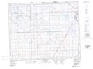
Maps showing Otthon, 26-24-5-W2, Saskatchewan
Otthon is a Hamlet located in 26-24-5-W2, Saskatchewan and has an elevation of 519 meters.
- Latitude: 51° 5' 48'' North (decimal: 51.0967555)
- Longitude: 102° 35' 48'' West (decimal: -102.5968055)
- Topography Feature Category: Hamlet
- Geographical Feature: Organized Hamlet
- Canadian Province/Territory: Saskatchewan
- Elevation: 519 meters
- Location: 26-24-5-W2
- Atlas of Canada Locator Map: Otthon
- GPS Coordinate Locator Map: Otthon Lat/Long
Otthon NTS Map Sheets