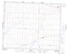
Maps showing Wiseton, 17-27-12-W3, Saskatchewan
Wiseton is a Village located in 17-27-12-W3, Saskatchewan and has an elevation of 577 meters.
- Latitude: 51° 18' 41'' North (decimal: 51.3113471)
- Longitude: 107° 39' 1'' West (decimal: -107.6503142)
- Topography Feature Category: Village
- Geographical Feature: Village
- Canadian Province/Territory: Saskatchewan
- Elevation: 577 meters
- Location: 17-27-12-W3
- Atlas of Canada Locator Map: Wiseton
- GPS Coordinate Locator Map: Wiseton Lat/Long