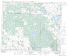
Maps showing Wood Hill, 31-48-8-W3, Saskatchewan
Wood Hill is a Unincorporated area located in 31-48-8-W3, Saskatchewan and has an elevation of 585 meters.
- Latitude: 53° 12' North (decimal: 53.2000521)
- Longitude: 107° 9' West (decimal: -107.1505880)
- Topography Feature Category: Unincorporated area
- Geographical Feature: Locality
- Canadian Province/Territory: Saskatchewan
- Elevation: 585 meters
- Location: 31-48-8-W3
- Atlas of Canada Locator Map: Wood Hill
- GPS Coordinate Locator Map: Wood Hill Lat/Long
Wood Hill NTS Map Sheets