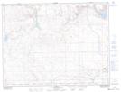
Maps showing Wright Coulee, 5,6-30-W3, Saskatchewan
Wright Coulee is a Valley located in 5,6-30-W3, Saskatchewan and has an elevation of 1064 meters.
- Latitude: 49° 25' North (decimal: 49.4166905)
- Longitude: 109° 57' West (decimal: -109.9507625)
- Topography Feature Category: Valley
- Geographical Feature: Coulee
- Canadian Province/Territory: Saskatchewan
- Elevation: 1064 meters
- Location: 5,6-30-W3
- Atlas of Canada Locator Map: Wright Coulee
- GPS Coordinate Locator Map: Wright Coulee Lat/Long
Wright Coulee NTS Map Sheets