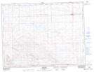
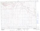
Maps showing Wrightville Coulee, 3,4-20-W3, Saskatchewan
Wrightville Coulee is a Valley located in 3,4-20-W3, Saskatchewan and has an elevation of 909 meters.
- Latitude: 49° 16' North (decimal: 49.2666823)
- Longitude: 108° 36' West (decimal: -108.6007003)
- Topography Feature Category: Valley
- Geographical Feature: Coulee
- Canadian Province/Territory: Saskatchewan
- Elevation: 909 meters
- Location: 3,4-20-W3
- Atlas of Canada Locator Map: Wrightville Coulee
- GPS Coordinate Locator Map: Wrightville Coulee Lat/Long
Wrightville Coulee NTS Map Sheets