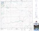
Maps showing Thomson Island, Saskatchewan
Thomson Island is a Island located in Saskatchewan and has an elevation of 339 meters.
- Latitude: 53° 14' North (decimal: 53.2333630)
- Longitude: 104° 28' West (decimal: -104.4671407)
- Topography Feature Category: Island
- Geographical Feature: Island
- Canadian Province/Territory: Saskatchewan
- Elevation: 339 meters
- Atlas of Canada Locator Map: Thomson Island
- GPS Coordinate Locator Map: Thomson Island Lat/Long
Thomson Island NTS Map Sheets