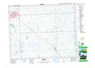
Maps showing Tonkin, 25,26-2-W2, Saskatchewan
Tonkin is a Unincorporated area located in 25,26-2-W2, Saskatchewan and has an elevation of 516 meters.
- Latitude: 51° 13' North (decimal: 51.2166661)
- Longitude: 102° 16' West (decimal: -102.2671386)
- Topography Feature Category: Unincorporated area
- Geographical Feature: Hamlet
- Canadian Province/Territory: Saskatchewan
- Elevation: 516 meters
- Location: 25,26-2-W2
- Atlas of Canada Locator Map: Tonkin
- GPS Coordinate Locator Map: Tonkin Lat/Long