Maps showing Touchwood Uplands, Saskatchewan
Touchwood Uplands is a Plain located in Saskatchewan and has an elevation of 620 meters.
- Latitude: 51° 15' North (decimal: 51.2500298)
- Longitude: 103° 45' West (decimal: -103.7505285)
- Topography Feature Category: Plain
- Geographical Feature: Uplands
- Canadian Province/Territory: Saskatchewan
- Elevation: 620 meters
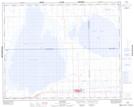
- Atlas of Canada Locator Map: Touchwood Uplands
- GPS Coordinate Locator Map: Touchwood Uplands Lat/Long
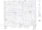
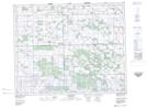
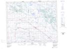
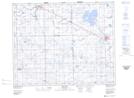
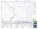
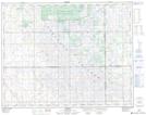
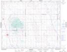
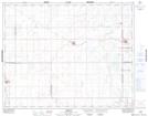
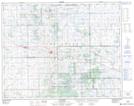
Touchwood Uplands NTS Map Sheets
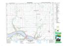
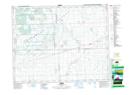
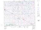
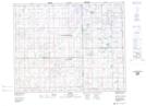
062L13 Fort Qu'Appelle Topographic Map at 1:50,000 scale
062L14 Lorlie Topographic Map at 1:50,000 scale
062M03 Goodeve Topographic Map at 1:50,000 scale
062M04 Jasmin Topographic Map at 1:50,000 scale
062M05 Kelliher Topographic Map at 1:50,000 scale
062M06 Parkerview Topographic Map at 1:50,000 scale
062M11 Sheho Topographic Map at 1:50,000 scale
062M12 Foam Lake Topographic Map at 1:50,000 scale
072I16 Cupar Topographic Map at 1:50,000 scale
072P01 Arbury Topographic Map at 1:50,000 scale
072P02 Strasbourg Topographic Map at 1:50,000 scale
072P07 Semans Topographic Map at 1:50,000 scale
072P08 Punnichy Topographic Map at 1:50,000 scale
072P09 Touchwood Hills Topographic Map at 1:50,000 scale
072P16 Wynyard Topographic Map at 1:50,000 scale
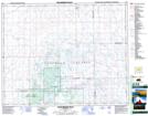
062L Melville Topographic Map at 1:250,000 scale
062M Yorkton Topographic Map at 1:250,000 scale
072I Regina Topographic Map at 1:250,000 scale
072P Wynyard Topographic Map at 1:250,000 scale