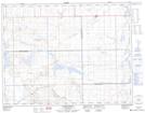
Maps showing Tunstall, 9-14-28-W3, Saskatchewan
Tunstall is a Unincorporated area located in 9-14-28-W3, Saskatchewan and has an elevation of 745 meters.
- Latitude: 50° 9' North (decimal: 50.1500518)
- Longitude: 109° 47' West (decimal: -109.7841122)
- Topography Feature Category: Unincorporated area
- Geographical Feature: Railway Point
- Canadian Province/Territory: Saskatchewan
- Elevation: 745 meters
- Location: 9-14-28-W3
- Atlas of Canada Locator Map: Tunstall
- GPS Coordinate Locator Map: Tunstall Lat/Long
Tunstall NTS Map Sheets