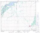
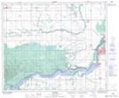
Maps showing Nipawin Regional Park, Saskatchewan
Nipawin Regional Park is a Conservation area located in Saskatchewan and has an elevation of 334 meters.
- Latitude: 53° 23' 40'' North (decimal: 53.3944856)
- Longitude: 104° 0' 2'' West (decimal: -104.0004600)
- Topography Feature Category: Conservation area
- Geographical Feature: Regional Park
- Canadian Province/Territory: Saskatchewan
- Elevation: 334 meters
- Atlas of Canada Locator Map: Nipawin Regional Park
- GPS Coordinate Locator Map: Nipawin Regional Park Lat/Long
Nipawin Regional Park NTS Map Sheets