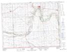
Maps showing Oxbow, 23-3-2-W2, Saskatchewan
Oxbow is a Town located in 23-3-2-W2, Saskatchewan and has an elevation of 566 meters.
- Latitude: 49° 13' 48'' North (decimal: 49.2299166)
- Longitude: 102° 10' 9'' West (decimal: -102.1692732)
- Topography Feature Category: Town
- Geographical Feature: Town
- Canadian Province/Territory: Saskatchewan
- Elevation: 566 meters
- Location: 23-3-2-W2
- Atlas of Canada Locator Map: Oxbow
- GPS Coordinate Locator Map: Oxbow Lat/Long