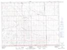
Maps showing Oungre Memorial Regional Park, 2-14-W2, Saskatchewan
Oungre Memorial Regional Park is a Conservation area located in 2-14-W2, Saskatchewan and has an elevation of 609 meters.
- Latitude: 49° 10' North (decimal: 49.1666980)
- Longitude: 103° 48' West (decimal: -103.8004963)
- Topography Feature Category: Conservation area
- Geographical Feature: Regional Park
- Canadian Province/Territory: Saskatchewan
- Elevation: 609 meters
- Location: 2-14-W2
- Atlas of Canada Locator Map: Oungre Memorial Regional Park
- GPS Coordinate Locator Map: Oungre Memorial Regional Park Lat/Long