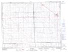
Maps showing Stoughton, 28-8-8-W2, Saskatchewan
Stoughton is a Town located in 28-8-8-W2, Saskatchewan and has an elevation of 619 meters.
- Latitude: 49° 40' 38'' North (decimal: 49.6773082)
- Longitude: 103° 1' 41'' West (decimal: -103.0281277)
- Topography Feature Category: Town
- Geographical Feature: Town
- Canadian Province/Territory: Saskatchewan
- Elevation: 619 meters
- Location: 28-8-8-W2
- Atlas of Canada Locator Map: Stoughton
- GPS Coordinate Locator Map: Stoughton Lat/Long