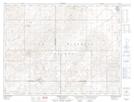
Maps showing Oro Lake Regional Park, 10-25-W2, Saskatchewan
Oro Lake Regional Park is a Conservation area located in 10-25-W2, Saskatchewan and has an elevation of 717 meters.
- Latitude: 49° 47' 15'' North (decimal: 49.7875311)
- Longitude: 105° 21' 12'' West (decimal: -105.3533356)
- Topography Feature Category: Conservation area
- Geographical Feature: Regional Park
- Canadian Province/Territory: Saskatchewan
- Elevation: 717 meters
- Location: 10-25-W2
- Atlas of Canada Locator Map: Oro Lake Regional Park
- GPS Coordinate Locator Map: Oro Lake Regional Park Lat/Long
Oro Lake Regional Park NTS Map Sheets