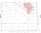
Maps showing Warrell Junction, Saskatchewan
Warrell Junction is a Unincorporated area located in Saskatchewan.
- Latitude: 50° 28' North (decimal: 50.4667070)
- Longitude: 104° 40' West (decimal: -104.6672170)
- Topography Feature Category: Unincorporated area
- Geographical Feature: Railway Point
- Canadian Province/Territory: Saskatchewan
- GPS Coordinate Locator Map: Warrell Junction Lat/Long