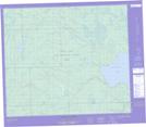
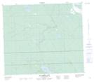
Maps showing McCusker Lake, 72-18-W3, Saskatchewan
McCusker Lake is a Lake located in 72-18-W3, Saskatchewan and has an elevation of 478 meters.
- Latitude: 55° 16' North (decimal: 55.2667541)
- Longitude: 108° 44' West (decimal: -108.7340787)
- Topography Feature Category: Lake
- Geographical Feature: Lake
- Canadian Province/Territory: Saskatchewan
- Elevation: 478 meters
- Location: 72-18-W3
- Atlas of Canada Locator Map: McCusker Lake
- GPS Coordinate Locator Map: McCusker Lake Lat/Long
McCusker Lake NTS Map Sheets