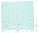
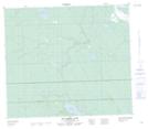
Maps showing Angus Creek, 74-18-W3, Saskatchewan
Angus Creek is a River located in 74-18-W3, Saskatchewan and has an elevation of 638 meters.
- Latitude: 55° 25' North (decimal: 55.4167538)
- Longitude: 108° 43' West (decimal: -108.7174073)
- Topography Feature Category: River
- Geographical Feature: Creek
- Canadian Province/Territory: Saskatchewan
- Elevation: 638 meters
- Location: 74-18-W3
- Atlas of Canada Locator Map: Angus Creek
- GPS Coordinate Locator Map: Angus Creek Lat/Long
Angus Creek NTS Map Sheets